SÃO JORGE
(PARISH OF SANTANA)
32°49′40″N 16°54′30″W
São Jorge is a Portuguese parish in the municipality of Santana, with an area of 18.30 km² and 1,173 inhabitants (2021), founded in 1515 by D. Manuel I, it is one of the oldest parishes in the region, with the current parishes of Santana , Arco de São Jorge and Ilha integrated into its original territory. Its population density is 64.1 inhabitants/km².
It is located at an altitude of 243 meters. It is connected to the Municipality of Santana by regional road 101 and expressway n.1. It is limited to the North by the Atlantic Ocean and to the South by mountains. To the west is the parish of Arco de São Jorge and to the east are the parishes of Ilha and Santana. Half of the parish is located in the middle of the Laurissilva Forest.
The main activity of the population is agriculture.
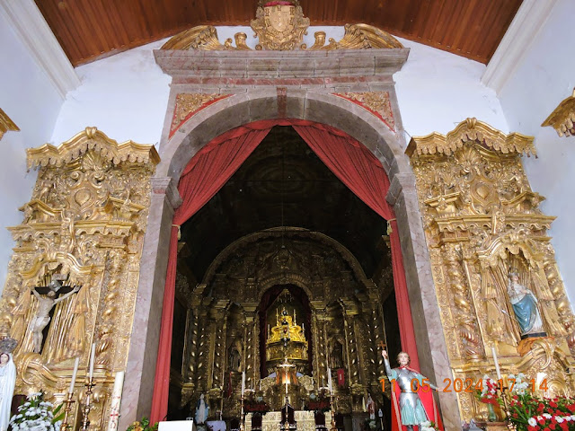
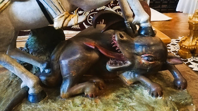
In this parish is located the Igreja Matriz de São Jorge, the most important baroque monument in the island's rural space, whose construction brings together architectural and decorative elements from the other three predecessor churches, which have since disappeared (the first two built next to the local coastline, the third in the same location as the current one). Its construction began in the 1830s, with the demolition of the New Church of Achada, and was dedicated on September 17, 1761, by D. Gaspar da Costa Brandão, bishop of Funchal. The matrix has a monumental Johannine altarpiece, two side altarpieces and two other collaterals, having six altars and counting on several important elements as a whole: the sacristy chest, the tabernacle, the main chapel ceiling, the 16th-century tiles and XVII and the pulpit deserve special attention.
This parish also has a chapel dedicated to Saint Peter, dating from the end of the 15th century, and a chapel dedicated to the Sacred Heart of Jesus, on the Ribeira Funda site, completed around the year 2000. There were, in its original historical territory, the chapels of Santana (15th century - built in the current parish of Santana), São Sebastião (16th century), Nossa Senhora da Piedade (16th century - built in the current parish of Arco de São Jorge), Santo António (16th/17th century - current parish of Santana), and Nossa Senhora do Rosário (18th century - located in the current parish of Ilha).
On the site of Calhau de São Jorge, the first economic and religious center of the community, where the first churches and industries in the locality were built, the military stronghold known as Forte de São Jorge was also built, consisting of a guard house, an arsenal, a triangular parade ground with two guardhouses (east), a turret (west), and a weapons gate. In the triangular parade ground, whose layout is still visible in the ruins (classified as a local monument), there were two 6 caliber artillery pieces, taken to the Fort of Nossa Senhora do Amparo, in Machico when the property was sold by the State.
The highest altitude is Pico Canário (1592m) followed by Pico dos Assumadouros (1184m).
São Jorge has a branch of the Santana secondary school, a primary and pre-primary school, an occupational activities center, a health center, and a day center.
In 2019, construction began on the Baroque Museum and the Treasury of the Main Church of São Jorge.
São Jorge Ruins
+
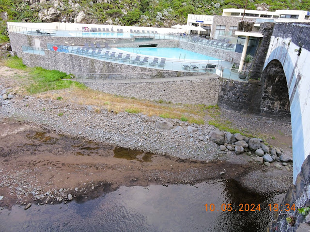
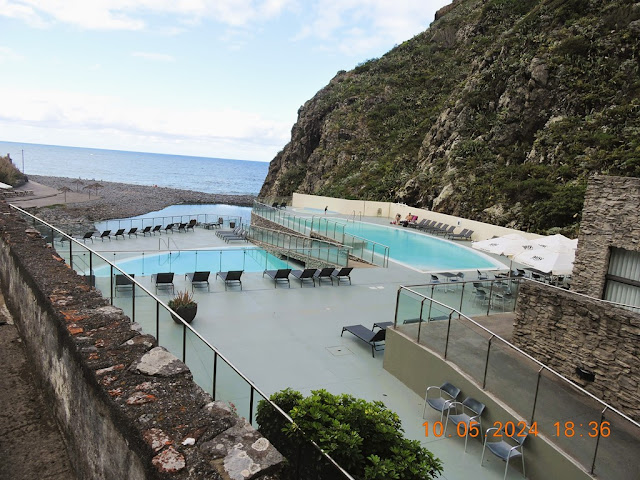
Calhau de São Jorge bathing complex
32.827846; -16.897930
The sugar cane culture in Madeira dates back to the 15th century. Due to the relevance that this agricultural species quickly gained in the territory, the island became a major supplier of sugar to the whole of Europe. In the São Jorge Ruins, visitors have the opportunity to travel through the pages of this history.
Located in Calhau de São Jorge, this center is formed by the ruins of the old sugar cane mills that were installed there in the early days of the island's settlement process. Of these old buildings, stands out the very well-preserved pebble entrance portico.
It should be noted that the whole of the São Jorge Ruins, municipality of Santana, has been classified as a Monument of Municipal Interest since 2003. It is therefore a place of great interest on the north coast of the island of Madeira.
Be sure to take advantage of this visit to also be surprised by the scenery offered by Calhau de São Jorge. This secluded beach on a small freshwater lagoon, in the bed of the Ribeira de São Jorge, is surrounded by a vibrant landscape, between the green hills and the ocean. Come and enjoy Madeira's Nature and history!
Details
The São Jorge Ruins, in Calhau de São Jorge, houses the ruins of the sugar cane mills that were built there in the early days of the island's settlement.
CAMINHOS REAIS
(REAL PATHS)
Royal roads (CAMINHOS REAIS) were the main roads and paths in mainland Portugal and the Portuguese Empire, whose construction and maintenance were the responsibility of the Portuguese Crown, directly or through its local representatives.
Mainland Portugal
In Portugal, the main roads run by the Crown were called "royal roads".
In the mid-19th century, when the first nationwide road plans were developed, the term "royal road" continued to be used to designate the main roads in the road network, which normally connected Lisbon to the various district capitals. Likewise, the numbering of roads was adopted. According to the Monarchy's last road plan, established in 1889, the national road network consisted of royal roads (national in scope), district roads (regional in scope) and municipal roads (local in scope).
After the establishment of the republic in 1910, the 1889 road plan remained in force, but the royal roads were now called "national roads".
Some sections of old royal roads are still included in the country's road network today. Other former royal roads out of current use remained as pedestrian routes. On Madeira Island, several of these ancient routes are currently recommended routes for walking.
Madeira Island
In Madeira Island, the construction of these roads began shortly after settlement, at the beginning of the 15th century, constituting the oldest land circulation network in the archipelago. It is estimated that there are currently around 400 kilometers of these roads in the region, with many sections hidden by vegetation or inaccessible due to the island's orography. Among the recommended walking routes in the region, three are old Caminhos Reais. In the region, its construction was generally promoted by governors and captains-general. In August 2015, the Regional Government began a project to restore the old Camino Real network, using as a pilot project the section of the old Camino Real that connected Paul do Mar to Ponta do Pargo.
Brazil
In Colonial Brazil, the construction of these roads was especially intense and related to mining activity. The historical-cultural heritage they represent is defended by the Estrada Real Project. The name "Royal Road" refers to any land route that, at the time of Colonial Brazil, was traveled in the process of settlement and economic exploitation of its resources, in conjunction with the international market.
Within a traditional historiographical view of Brazilian History, the concept of Estrada Real presupposes:
official nature;
exclusivity of use;
link with mining.
From this perspective, the designation "Royal Road" reflects the fact that this was the official route, the only one authorized for the movement of people and goods. The opening or use of other routes constituted a crime of lèse majeste, which is where the expression embezzlement comes from, with the meaning of smuggling.
On the other hand, a contemporary view admits:
-traditional nature and a reference for good paths;
-general, universal, public use;
-link with other activities, such as commerce and livestock farming;
-stocks before or after mining;
-detached from mining areas.
In defense of the latter, it should be considered that the Kingdom's ordinances, also observed in the Colony, established as royal rights or privileges, among others, public roads, rivers and scallops, and mines of gold and silver or any other metal .
The paths of Minas Gerais, between the 17th and 19th centuries, corresponded to a set of land routes, many of them simple reappropriations of old Indigenous trails (peabirus), which brought different regions of Brazilian territory together:
The so-called Caminho da Bahia or Caminho dos Currais do Sertão and its variants, connecting the Captaincy of Bahia to Minas;
The so-called Caminho do Rio de Janeiro (later called Caminho Velho do Rio de Janeiro; currently, Estrada Real) and its variants, connect the Captaincy of Rio de Janeiro to Minas.
Later, with the discovery of diamonds in Serro, between 1725 and 1735, a new path was opened, the so-called Caminho dos Diamantes, which would join the Picada de Goiás and Mato Grosso (Caminho de Cuiabá or Picadão de Cuiabá), when minerals were discovered in these last regions.
Among the genres transported are:
- standing cattle, from the corrals in the backlands between the Captaincy of Minas and Bahia;
-luxury products and slaves, from the ports of Salvador (Bahia) and Rio de Janeiro;
-horses from the Captaincy of Pernambuco.
Calhau São Jorge - Ramal do Caminho Real 23
https://www.alltrails.com/pt-pt/trilho/portugal/madeira--2/calhau-sao-jorge-ramal-do-caminho-real-23
São Jorge Mother Church
32.82739485747507, -16.907036182711675
Located in the parish of São Jorge, municipality of Santana, lies the largest baroque-style church in the entire Autonomous Region of Madeira. Therefore, the São Jorge Mother Church is a point of interest not to be missed when visiting the island's north coast.
Built in the 17th century, this religious monument is considered a symbol of the built heritage of the municipality of Santana. The peculiarity of the São Jorge Mother Church is revealed, right from the start, in the main façade, which faces north and whose fenestration is unusual in the context of regional typology. The portal is topped by three apron windows and, in the tympanum, another window appears flanked by pilasters supporting the straight cornice.
The longitudinal plan of the building is composed of a single nave and a chancel, lower and narrower, with a quadrangular bell tower. At the top of the nave, the presbytery is marked by a web of balusters, in rosewood, which form a curve on the sides. You can also admire the altarpieces in Joanine's gilded woodcarving and the paintings on canvas.
There are plenty of reasons to come and quietly contemplate the architectural beauty of the São Jorge Mother Church, one of the most important monuments of Madeira's religious heritage.
VIGIA VIEWPOINT
32.834187, -16.911408
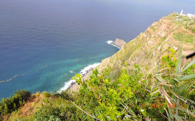
Known as the 'pearl of the Atlantic', Madeira Island reveals a historical symbiotic relationship with the sea that surrounds it. The ocean is, therefore, the undisputed protagonist of some of the archipelago's iconic sceneries. This is the case of the Vigia viewpoint, once used to closely observe the large species that inhabit these waters.
Located in the parish of São Jorge, municipality of Santana, this viewpoint offers an unparalleled panoramic view over the west shore of the north coast of the island of Madeira. Visitors have the opportunity to extend their sightline from Arco de São Jorge, a small seaside town known for the fertility of its soils as a result of its microclimate, to Porto Moniz, famous for its natural volcanic pools.
In between, you can also see Ponta Delgada, with its small 'natural amphitheatre' facing the sea, or Seixal, a town surrounded by green mountains. On days with good visibility, the Vigia viewpoint offers a view to the island of Porto Santo. Enjoying a unique geographical position, this place was, for a long time, a privileged whale-sighting spot.
Details
In the parish of São Jorge, the Vigia viewpoint offers a unique panoramic view of the west shore of the north coast of the island. It was once used for whale-sighting.
WATERMILL
32.820014, -16.914778
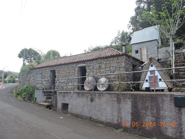
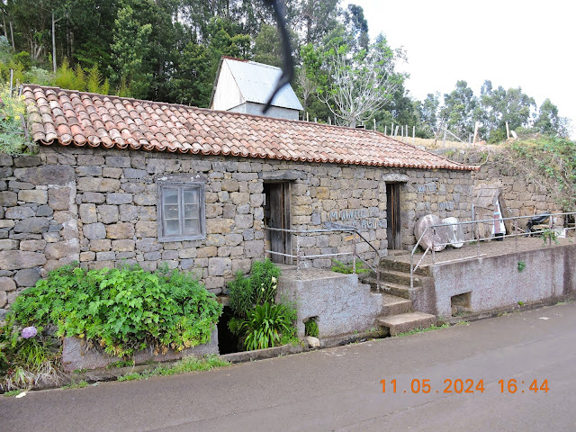
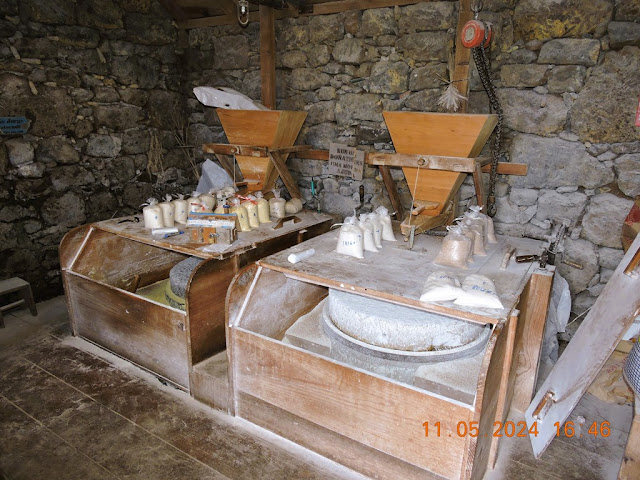
Watermills powered by the water of the 'levadas' (water channels) are part of the History of the Island of Madeira. Well, in the parish of São Jorge, municipality of Santana, it is still possible to have the opportunity to watch the last working watermill on the island.
Located in Achadinha, its history goes back more than 300 years. However, after undergoing a restoration process in 2000, it is now fully functional. It is powered by the waters of the Levada do Rei, which crosses part of the exuberant forest cover of the north coast of Madeira.
Even today, the people of the region still use this watermill to mill wheat, corn, barley and rye, grown mainly on the agricultural terraces of São Jorge, as was formerly common practice all over the island. It is, therefore, a site of great relevance, where visitors can observe up close how the driving force of water was used to ensure the subsistence of the population.
Embark on this journey through Madeiran tradition and let yourself be surprised by the beauty and importance of the historical and cultural heritage that the island preserves.
Details
Over 300 years old but recently restored, the São Jorge watermill is located at Achadinha and is the last one operating in the island of Madeira.
💝💝💝💝💝
SEARCH IN
SANTANA MUNICIPALITY
Return to mainland Portugal and
to the Azores and Madeira islands

















No comments:
Post a Comment