Tuesday, May 28, 2024

😍😍 PARISH OF ILHA (SANTANA MUNICIPALITY)


ILHA
(PARISH OF SANTANA MUNICIPALITY)
32°47′21″N 16°55′4″W

Ilha is a civil parish of Santana municipality in the archipelago of Madeira. The population in 2011 was 255, in an area of 14.19 km².

History
The history of this parish extends from the end of the 20th century when it was created in 1989 by de-annexation from the civil parish of São Jorge. Its name was an extension of geomorphological characteristics, since it was an "island" between many of its other neighbours (ilha is the Portuguese word for island), one of the few landlocked parishes on Madeira.

Geography
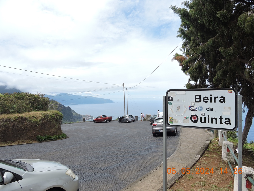
Ilha is located along the northern coast, buttressed by the neighbouring civil parishes of Arco de São Jorge (in the west) and São Jorge (to the east). It contains the localities Achadinha, Corrida, Ermida, Garnal, Lombada do Meio and Lombo Grande.

The site of Achada do Marques is classified as a protected landscape and part of the Parque Natural da Madeira. The classification was made to not only preserve the natural environment and landscape, but also to maintain the habits and traditions of the zone. Caldeirão Verde, another popular tourist destination in the parish, is part of the pedestrian trails that cross the island. In particular, from Caldeirão Verde, it is possible to follow a trail through the UNESCO-protected Laurisilva forests to the locally-known Cascata do Caldeirão Verde (waterfall of Caldeirão Verde). In addition, Pico Ruivo, the highest point on the island at 1,862 metres (6,109 ft) falls within the parish frontiers, and although a highly difficult climb (third highest nationally), its summit can be reached from within the trail network. Other pedestrian trails of note: are Levada da Ilha-Vale da Lapa-Caldeirão Verde and Pico Ruivo-Encumeada.

Economy
Its primary economic resource is the agricultural industry, served by dairy and cattle-raising. In addition, it supports a small economic collectivity that includes small shops, cafes and bars, and health care centres. A locally produced beverage/liquor, "Ponchilha", based on lemons of this region.

Culture
In August, the Casa do Povo da Ilha organises a Dia do Emigrante (Emigrant Day) for those former residents who left Ilha looking for better economic conditions. On the last weekend of September and the first of October, the festivals in honour of the Santissimo Sacramento (Holy Sacrament) and patron saint (Our Lady of the Rosary) are also celebrated. Finally, at the end of November and beginning of December, the Semana Cultural da Ilha (Cultural Week of Ilha) result in various cultural activities based on a specific theme.


😍😍 PARISH OF ARCO DE SÃO JORGE (MUNICIPALITY OF SANTANA)


ARCO DE SÃO JORGE
(PARISH OF SANTANA)
32° 49' 38" N 16° 57' 18" W

Arco de São Jorge is a Portuguese parish in the municipality of Santana, with an area of ​​4.00 km² and 416 inhabitants (2011). Its population density is 118 inhabitants/km². It is located at latitude 32.81667 (32°49') North and longitude 16.95 (16°57') West, at an altitude of 124 meters. The regional road that passes through this parish gives access to the municipality of Santana and S. Vicente. The main activities of the population are agriculture and viticulture. It has a coastline on the Atlantic Ocean to the north and mountains to the south.
HistoryArco de São Jorge
The origin of the name of the Parish of Arco de São Jorge comes from the hills that surround it in the shape of an “arch”. Until 1676, the territory of the current parish belonged to the Parish of São Jorge, from which it inherited the “appendix” of “São Jorge”. Arco de São Jorge was elevated to the category of parish on December 28 of that same year.

It belonged to the Parish of São Jorge since it was created in 1515, but in 1676 it was separated and then called Arco de São Jorge.

One of the first settlers of Madeira was Pedro Gomes Galdo, who had large sesmaria lands in São Jorge and Boaventura, and it can be assumed that they included the lands that later constituted the parish of Arco de São Jorge. It is thought that the Parish of Arco de São Jorge was populated between the end of the 15th century and the first quarter of the 16th century, shortly after the beginning of the settlement of Calhau de São Jorge.

This small parish is one of the most fertile in the entire north of Madeira Island. It produces all agricultural products, with great emphasis on the cultivation of sugar cane.

One of the main sites in the Parish of São Jorge is Quebrada, which got its name from the large ravine that occurred in the past, separating itself from other land nearby, mainly from Arco Pequeno.

In the 16th century, the local population of this parish came from mainland Portugal, specifically Minho and Algarve.

Its primitive hermitage, dedicated to Nossa Senhora da Piedade, from the end of the 16th century, was located in the current Sítio dos Casais, having served as the parish headquarters when the parish was created. On January 18, 1740, the construction of a new parish church was carried out, due to the chapel of Nossa Senhora da Piedade being in a regrettable state of conservation. On March 31, 1748, an earthquake caused great damage to the Parish Church.


-
Beira da Quinta Viewpoint
32.826360, -16.938962

The Beira da Quinta viewpoint offers one of the most surprising landscapes on the north coast of the island of Madeira. It is a mandatory stop in the municipality of Santana, perfect for a peaceful contemplation of the beauty of the mountains that rise up by the sea.

This viewpoint is located between the parishes of São Jorge and Arco de São Jorge. It therefore offers a wide view, especially over this last place, famous for the fertility of its soils as a result of the microclimate it enjoys. But the panorama is far from limited to this picturesque village.

From the Beira da Quinta viewpoint you can practically see the whole northwest coast up to Porto Moniz, a place that has as its calling card its unique natural pools formed from volcanic rocks. The beauty of the monumental coastal cliffs, which reach a height of around 500 metres, stands out in this encompassing scenery.

As it is situated at an altitude of 469 metres, the view offered by this viewpoint reaches is remarkably far-reaching. On clear days, it is possible to see the silhouette of the island of Porto Santo floating in the sea, a few miles to the northeast.

Details
Located between the parishes of São Jorge and Arco de São Jorge, the Beira da Quinta viewpoint offers an ample view over the northwest coast of the island.


Arco de São Jorge Viewpoint 
32.828831, -16.954514

Small viewpoint, next to sports facilities, with bathroom. At a much lower altitude than the Beira da Quinta viewpoint, and very little visited, it offers some beautiful views.